TRIP REPORT: Lemon Squeezer and Island Pond Mountain via Lake Askoti – Harriman State Park, NY 6-11-16
Hiking stats at a glance:
Trailhead: Lake Askoti Trailhead
Miles round trip: ~8
Hike Highlights: Lake Askoti, “Lemon Squeezer”, Appalachian Trail, NY Long Path, Island Pond Mountain, Surebridge Mountain
Total Time: ~3 hrs
Harriman State Park is another one of those local places I have always avoided but finally decided to listen to my friend Stav from www.Stavislost.com and was so glad I finally did. On this particular trip I was looking to do an easy but nice hike with my buddy Brandon who was up from North Carolina to visit. I didn’t have high hopes for this hike to be honest but it turned out to be quite varied and beautiful throughout. I also finally got to tackle the lemon squeezer I have been hearing so much about forever reading books about the Appalachian Trail!
We started the hike from the Lake Askoti trailhead parking lot under cloudy grey skies. Despite showing up at around noon we were still able to nab a prime parking spot. I think the threat of rain may have kept a lot of people home or at least convinced them to call it a day early. However, even though the parking lot was jam packed we hardly saw anyone all day on the trail.
The parking lot sits right on the bank of Lake Skannatati which all by itself was beautiful and would have been a great place to hang out and relax all on its own. The trailheads namesake, Lake Askoti is actually across the street from the parking lot.
The trail itself started just a few feet away at the edge of the parking lot.
At the actual trailhead are two separate trails you can follow. We decided to take the green blazed Long Path up towards the Lemon Squeezer. For those who might be unfamiliar the Long Path is a trail that extends 357 miles from the 175th Street Subway Station in New York City to John Boyd Thacher State Park near Albany, NY. One day I would like to traverse the entire length from start to finish.
The trail starts out fairly flat as you traverse along the side of the lake through the woods which is strewn with large boulders. The trail itself is well marked and easy to follow as it rolls along gentle hills before taking you deeper into the woods beyond the lake.
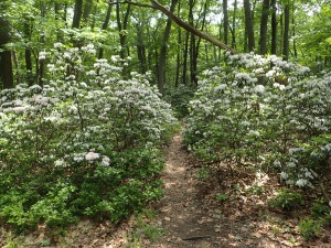
We worked our way down the trail and up and down the rolling hills at a good pace. The trail is pretty rocky overall but nothing that would really slow you down too much. It was also nice that many of the flowering bushes were in full bloom which added a nice hint of color to the already bright green foliage.
Before too long we reached the junction with the Yellow Blazed Dunning trail. From here it was just a short section of double marked Green and Yellow blazed trail before we turned right back on to the Green Blazed Long Path.
A couple hundred feet down the trail we reached a rock outcrop with Green Blazes on it which marked the continuation of the Long Path. We made a right down the trail and kept moving along at a nice pace.
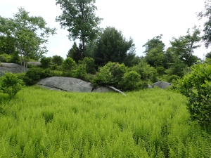
From here the trail continued over gently rolling hills and through more bright green ferns which really were a highlight of the day for me overall. They are not terribly unique but I find them beautiful and they really always make me feel like I am home.
After another 0.8 miles we reached the 4 way intersection referred to as “Times Square”. Unlike the “Times Square” you run into hiking the Santanoni Range in the Adirondack High Peaks, this one is clearly marked and resembles what you would expect an intersection by this name to look like. It also has a large sign painted on a boulder which doesn’t hurt.
From Time Square we headed straight ahead down the Long Path. The trail was not extremely obvious as it was a little overgrown but if just look for the green blazes you should be able to find it without much trouble.
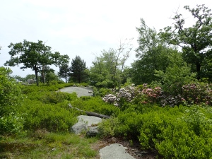
One thing I loved about this hike overall was how the landscape seemed to change constantly. Every half mile or so took you into a different landscape which kept things interesting. As we made some progress the trail began to get a bit rockier as we descended back down hill for a short section.
Before long we reached the next junction which was with the Red blazed trail and the Long Path. At this point we deviated from the Long Path and kept going forward down the Red blazed trail towards the Lemon Squeezer. Turning right and continuing on the Long Path would of taken us into the Dismal Swamp, which sounded interesting but we decided to save it for another day.
From this junction it was only a short 0.25 mile section of trail before we reached the Lemon Squeezer.
The Lemon Squeezer itself is on the Appalachian Trail and is right at the junction of the Red blazed trail and AT. The trail goes through a large outcrop and follows the obvious weakness between the boulders.
The Lemon Squeezer overall is really just one tight squeeze and a short section of rock scramble. It is not terribly difficult but it is still a pretty neat feature on the trail. However, I can still see how it would be challenging to navigate if you are through hiking the AT with a large backpack and are already tired from countless miles of hiking.
After finish the tight squeeze its just about 100 feet to the next and only other major obstacle which is a short maybe 5 foot scramble up a short rock face. However, if you’re not feeling up to the scramble there is an easy way down and around the left.
Once you pass the scramble one last section of rocky trail you are all finished up with the Lemon Squeezer. All in all it didn’t take much time or effort to navigate but it was certainly pretty cool.
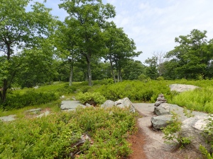
After finishing the Lemon Squeezer it was like we got transported to a totally different location as the landscape changed as we climbed the ridge of Island Pond Mountain. From here the trail from here is easy to follow as it climbs gently up the ridge and through the grassy landscape.
After passing the ridge we descended back down into the woods. From here the landscape transitioned again into a dark swampy feeling forest with tall coniferous trees and limited ground vegetation. This was just another one of many transitions we encountered throughout the hike.
Before too long we reached another trail junction with the Long Path and AT. We decided to stay on the AT instead of backtracking the way we had come. The sign at the junction was also pretty neat as it marked mileage to Katahdin in Maine and Springer Mountain in Georgia.
Following the AT from this point was a straightforward affair but it was also by far the rockiest and root strewn trail we encountered all day. The condition of the trail didn’t slow us down much but it was definitely a tougher section than the rest of the hike. The trail also gains a bit of elevation from this point as you make your way towards the ridge of Surebridge Mountain and then back down the other side towards Surebridge Brook.
Once we reached Surebridge Brook, which was really more of a swampy pool, a short crossing deposited us on the old Surebridge Mine Road. From here we made a left down the flat and well traveled road before following the AT back into the woods.
After passing back into the woods the AT continues its gentle stroll towards the ridge of Finger Board mountain. The trail slowly begins to get brighter and more green as you get closer to the ridge.
Before too long we transitioned yet again to a bright and open ridge full of green foliage and sunshine.
Once we were on the ridge proper a short 0.1 mile section took us to our next trail junction. From here the Blue blazed trail leads you to Fingerboard Shelter which is only a few hundred feet off the trail and to Seven Lakes Drive beyond. We hung a right down the Blue blazed trail and headed towards the road which we intended to walk back towards the trailhead parking lot to finish up our hike.
The Fingerboard shelter actually sits in a very beautiful little meadow on the side of the ridge. From here I believe you can actually get semi clear views of NYC lit up at night in the distance which seems like a neat thought to me given how remote the location feels when you’re there.
From the shelter the trail can take a minute to find but just look for the Blue blazes on the trees and you should be able to track it down. We followed this last stretch of woods down the hill and towards the road.
Before too long we reached the road and hung a right back down the road towards the trailhead. From here it was about a mile or so walk down the road.
As we neared the parking lot we were also able to walk along the side of Lake Askoti and take in that view as well.
We finished the hike in about 3 hours total. The loop we choose could have certainly been much longer and we could have also avoided walking the road but given the amount of time we had on the day this was a pretty nice hike overall. We got to see a lot of varied terrain and traveled over a few interesting features. It was also very nice that the forecasted rain never really showed up and we had a great day hiking in the warm weather. All in all I really enjoyed my first trip to Harriman State Park and considering how well this experience went I absolutely plan on coming back to see more so keep an eye out for future posts!
Categories: Harriman State Park, New York, Trip Reports


1 Comment »